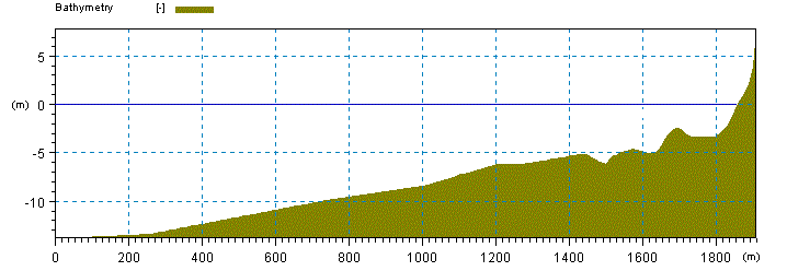
You may generate a cross-section bathymetry file by the use of the Profile Editor. A cross-section profile bathymetry describes the bed level values along a straight line with equidistant grid steps compared to a base level (often set as the mean water level, MWL). The profile origin should be positioned at a chosen off-shore water depth, and the profile extends in the direction of the shoreline along an axis, which is perpendicular to the depth contours. The last points in the cross-shore profile should reflect dry land.
This bathymetry is considered to be representative along a longer stretch of the coastline such that one can assume long and uniform depth contours in the calculation.
Figure 5.2 Example of cross-shore profile bathymetry
![]()