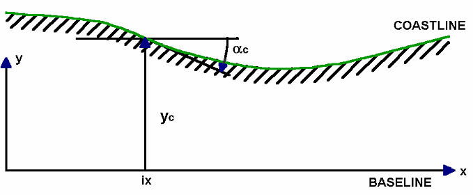
The coastline evolution calculations are based on a co-ordinate system in which the x-axis is a baseline that runs parallel to the primary coastline orientation, while the y-axis runs from the baseline in offshore direction, see Figure 5.21.
Figure 5.21 Coordinate system in coastline evolution model
The coastline is defined by the variation of yc in the longshore (x) direction, while the cross-shore profile defines the water depth (bottom position) as a function of the cross-shore position relative to the coastline position yc. The local variation of yc determines the local cross-shore profile orientation ac.
![]()