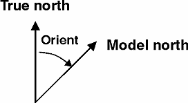
The orientation is defined as the angle between true north and the y-axis of the grid measured clockwise (“North to Y orientation”). A mnemonic way of remembering this definition is by thinking of NYC, which normally means New York City, but which for our purpose means "from North to the Y-axis Clockwise", see Figure 4.17.
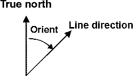
Figure 4.17 Definition of grid orientation (left) and line orientation (right)
The grid rotation defines the clockwise rotation of the grid from map projection north to model north (y-axis of the grid).
The line rotation defines the clockwise rotation of the line from map projection north to the direction of the line.
PLEASE NOTE:
The grid/line rotation in general is not equal to the North to Y orientation as the map projection north deviate increasingly from true north the longer away from the center of the map projection domain the model area is placed, see Figure 4.18.
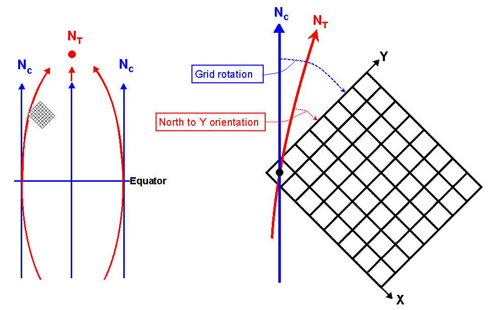
Figure 4.18 Left: Chart north (Nc) and true north (NT) for single UTM zone.
Right: Difference between Grid rotation and North to Y orientation.
![]()