
The input file is an ASCII file containing bathymetry data in ADCIRC format (.14). The file first defines the location of the individual node points, next the elements with associated node numbers.
· The mesh is created using map projection UTM-32 and the (X,Y) coordinate unit and the unit for the z-values in the input are specified as meter.
Note that for an ADCIRC bathymetry the depth values are automatically multiplied with -1 before the mesh is saved.
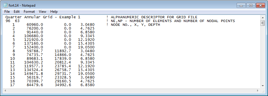
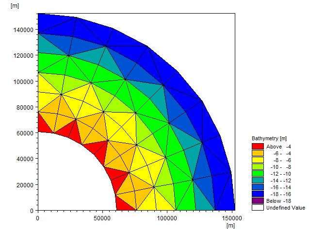
Figure 9.4 Mesh conversion of ADCIRC bathymetry data
Upper: start of input bathymetry data in ASCII file
Lower: output mesh
![]()