
The input file is an ASCII file containing bathymetry data in SMS/TuFlow format (.2dm). The file first defines the elements with associated node numbers, next the location of the individual node points.
· The mesh is created using a geographical coordinate system (LONG/LAT). The (X,Y) coordinate unit is specified as being degrees and the z-values as being defined in US survey feet.
Note that the bathymetry values in this instance should be multiplied by -1 before applying the mesh in MIKE Zero.
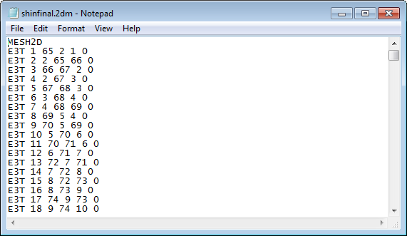
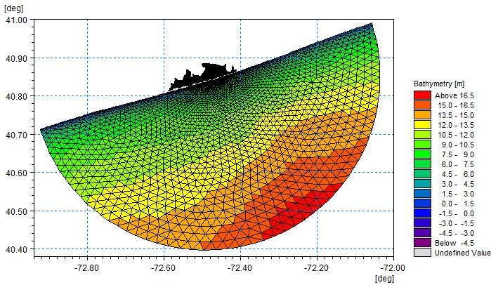
Figure 9.5 Mesh conversion of SMS bathymetry data
Upper: start of input bathymetry data in ASCII file
Lower: output mesh
![]()