This tool has been implemented to transform MIKE 21 grid data files into ESRI’s ArcView txt format.
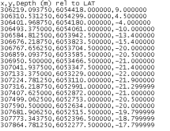
An example of ESRI’s ArcView txt format is shown below.
Figure 13.1 Example of resulting txt file (derived from Donegal bay bathymetry).
Only part of file (the top) is shown.
![]()