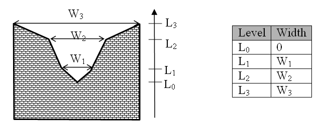
The weir geometry defines the geometrical shape of the active flow area of the weir. Geometry is defined as a Level-width relationship, where the Level/Width table defines the Weir shape as a set of corresponding set of levels and flow widths. Values in the levels column must be continuous, increasing values.
Levels are defined relative to the datum (starting from the crest or sill level and up). E.g. for a horizontal weir positioned at invert level -10 m (bed level) and extending 6 m above the bed, the weir could should be defined by L0= -4 m and L1= 0 m.
Datum defines an offset which is added to the level column in the level/width table during computation. This is typically used if the weir geometry has been surveyed with respect to a local benchmark.
Figure 6.5 Definition sketch of broad crested weir geometry
![]()