You must select the map projection (Longitude/Latitude, UTM, etc.) in which you want to specify the horizontal location of the source point.
In case of a 3D simulation you must specify the horizontal coordinates and the vertical position. The vertical position can be specified in four different ways:
· Layer number
· Distance below surface
· Distance above bed
· z-coordinate
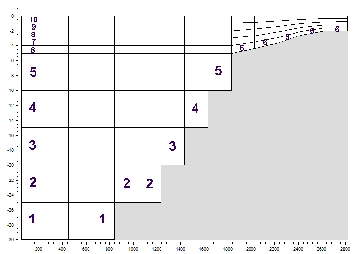
When layer number is selected you must specify the number of the layer in which the source should be placed. The layers are numbered 1 at the lowest layer and increasing upwards. In case of a combined sigma-z level mesh some of the bottom layers may be inactive, i.e. the bed layer number may be above 1, see Figure 6.3. In case a source is defined by a layer number which is below the active bed layer, the source will be applied into the active bed layer.
Figure 6.3 Example of layer numbers in source specification for combined sigma-z level mesh
When Distance below surface or Distance above bed is selected you must specify the distance. When z-coordinate is selected the z-coordinate of the source must be specified given in the coordinate system in which the bathymetry is defined and corrected corresponding to the datum shift specified on the domain page.
![]()