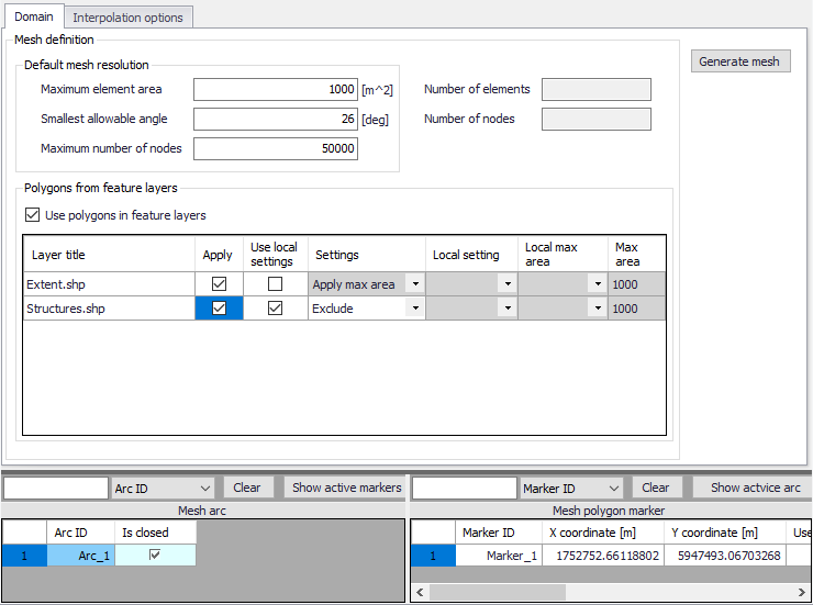
For flexible meshes, the Domain tab is where mesh resolution, overall extent, and local mesh area properties may be defined.
Figure 3.8 The Domain tab for configuring new flexible meshes in MIKE+
The first step to build a flexible mesh is to specify the ‘Default mesh resolution’, which will apply in locations where no local mesh resolution is defined. Under this ‘Default mesh resolution’ section, set values for various default mesh generation criteria. These include:
· Maximum element area. Area upper bound for elements in the mesh to be generated.
· Smallest allowable angle. Target smallest interior angle for elements in the generated mesh.
· Maximum number of nodes. Upper limit for number of element vertices in the mesh to be generated.
The second step is to define Mesh polygons and arcs, to apply local mesh resolutions. Polygons are used to define the overall extent of the mesh, as well as areas where local mesh settings shall be applied. These areas may be defined using:
· Feature layers. When the option 'Use polygons in feature layers' is active, polygons from feature layers may be used for the mesh generation. The layers must be added to the Map before use in mesh generation. Usable feature layers are automatically listed. Activate the 'Apply' option for layers to use and adjust the settings below:
- Use local settings. If this option is not selected, the default mesh resolution will apply within the polygon: the effect of the polygons is limited to the fact that mesh elements will be somehow aligned to the polygons. If this option is selected, then local settings controlled by the following parameters will be applied in the polygons.
- Settings. Three settings definitions are available:
‘Apply max area': For this setting, all polygons in the feature layer will use the same local mesh resolution, controlled by the value specified for the 'Max area'.
'Exclude': For this setting, all polygons in the feature layer will be excluded from the mesh. Not other input is required.
'Layer attributes': For this setting, each polygon in the feature layer may have its own local mesh resolution, which is controlled by the attributes of the layer. In the 'Local setting' column, it is required to select an attribute from the feature layer, containing the type of setting for each polygon: this must be a text attribute, and for each polygon the text must be either 'local area' or 'exclude' (case insensitive). In the 'Local max area' column, it is required to select an attribute containing the maximum element area for each polygon, to be used for polygons included in the mesh.
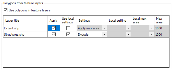
Figure 3.9 List of polygon features that may be used for mesh generation in the Domain tab page
· Mesh arcs and polygon markers. Mesh arcs and polygon markers are drawn on the Map. Arcs are lines or polylines that are open or closed. Closed arcs have the same first and last nodes, to create a polygon. A polygon marker may be added within a polygon, in order to specify the local properties of the mesh in the polygon (see Figure 3.10). A polygon without marker will be meshed with the default mesh resolution.
Define arcs and polygons on the Map using the Flooding Layer Editing toolbar (Figure 3.10) or the Edit Features toolbox on the 2D Overland menu ribbon (Figure 3.11). Select ‘Mesh arc’ as the target layer from the toolbar and use the ‘Create’ tool to draw arcs on the map.
Mesh polygon markers define local mesh properties in the encapsulating polygon. A polygon may only have one polygon marker.
Records for defined domain definition layers (i.e. arcs and polygon markers) are shown in the table at the bottom of the 2D Domain editor (Figure 3.12). The 'Show active marker' button, in the table of arcs, may be used to find the marker located in a given closed arc: select the relevant arc in the table, press the button, and the number of the corresponding marker in the table will be highlighted in dark blue. Similarly, the 'Show active arc' button, in the table of markers, may be used to find the encapsulating arcs: select the relevant marker in the table, press the button, and the numbers of the corresponding arcs in the table will be highlighted.
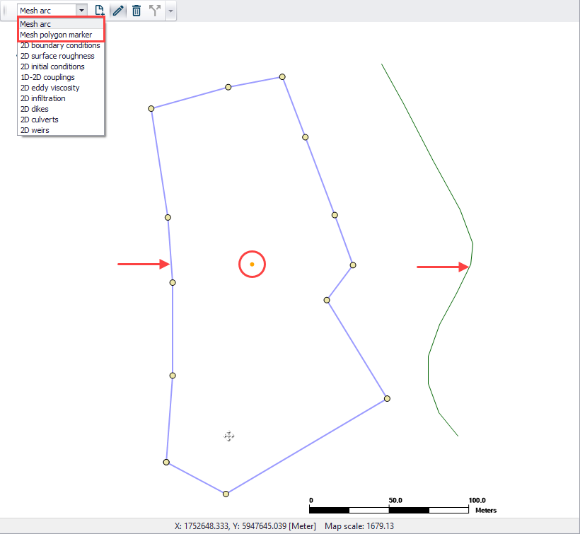
Figure 3.10 Define arcs and polygons on the Map via the Flooding Layer Editing toolbar. The figure shows a closed and open arc indicated by the arrows, and a polygon marker (encircled).
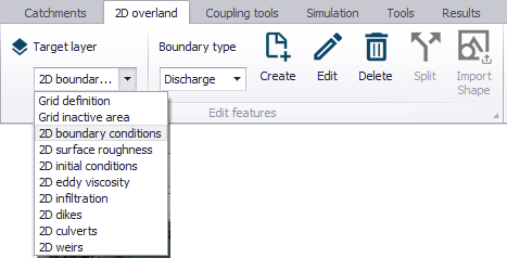
Figure 3.11 The Edit Features toolbox on the 2D Overland menu ribbon
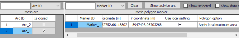
Figure 3.12 Mesh arcs and polygon markers grid table at the bottom of the 2D Domain editor
It may sometimes happen that a polygon from feature layers and a polygon defined by closed mesh arcs overlap (one being eventually fully included in the other one). In this case, the following rules apply:
· If one polygon is requested to be meshed and the other polygon is requested to be excluded from the mesh: then the priority is given to the polygon excluded from the mesh, and all the area covered by this polygon is excluded (even the parts covered by the other polygon).
· If the two polygons are requested to be meshed: priority is given to the polygon from the feature layer. In this polygon, the mesh will get the resolution requested for this polygon, even in the parts covered by the polygon defined with mesh arcs.
· If the two polygons are requested to be excluded from the mesh: the total area from the two polygons is excluded from the mesh.

Note that building areas can be excluded from the simulation, in order to take the effect of the obstacles on the flow. However, if rainfall is to be applied on the 2D domain, the volume of rain falling on the buildings will not be accounted for. The use of 2D Infrastructures is an alternative solution to describe buildings, which can keep taking into account the rainfall volume falling on buildings.
![]()