This tab is accessible only when generating Rectangular Grids. It is where areas for inactive cells in the computational grid (other than closed boundaries) are defined.
Inactive cell values, as configured in the Domain tab (i.e. Elevation threshold for inactive cells), are assigned to these cells. These areas may be defined with:
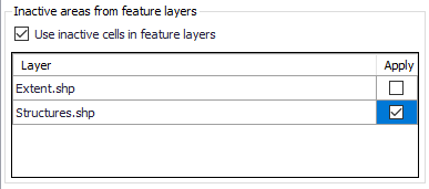
· Feature Layers. Polygon feature layers loaded to the Map prior to grid creation. The layers must be added to the Map before use.
Figure 3.13 List of polygon features that may be used to define inactive cells for rectangular grids
Usable feature layers are automatically recognized by the program and included in the layer list in the editor. Activate the ‘Apply’ option for layers to use and tick on the ‘Use inactive cells in feature layers’ option to use the applied layers during grid interpolation. All cells within a polygon from the applied layers will be excluded from the computation.
· Polygons. Define inactive polygons on the Map using the Flooding Layer Editing toolbar (Figure 3.10) or the Edit Features toolbox on the 2D Overland menu ribbon (Figure 3.11). Select ‘Grid inactive area’ as the target layer from the toolbar and use the ‘Create’ tool to draw polygon features on the map.
Records for defined polygons are shown in the ‘Grid inactive area’ secondary table at the bottom of the Inactive Areas tab page.
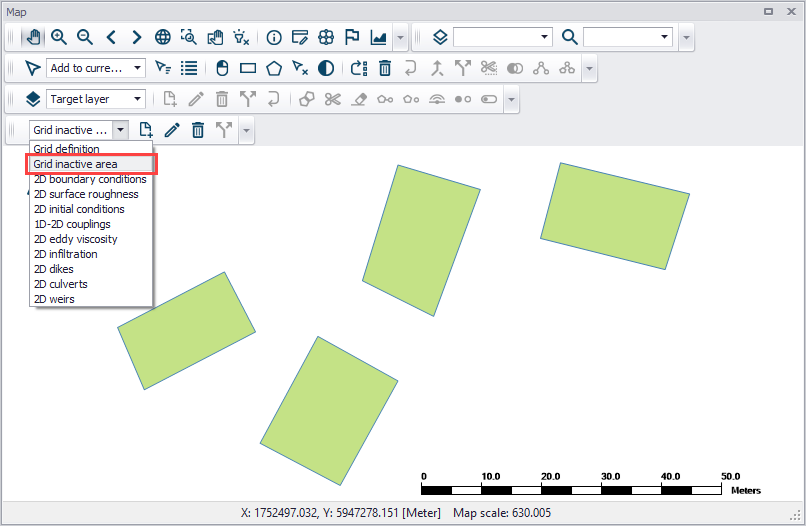
Figure 3.14 Use the Flooding Layer Editing toolbar to create Grid Inactive Area polygons on the map.
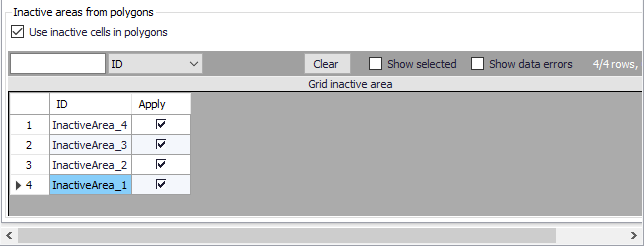
Figure 3.15 Grid inactive area secondary table at the bottom of the Inactive Areas tab page
Inactive area polygons for rectangular grids may be re-used as mesh area polygons for excluded areas during flexible mesh generation. A warning message is issued when switching from rectangular grid to flexible mesh domains after grid inactive areas have been created. Clicking on the ‘Yes’ button will add the previously-applied grid inactive areas to the mesh domain polygons.
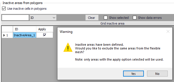
Figure 3.16 Warning message offering to option to use grid inactive areas a mesh domain polygons.

Note that building areas can be excluded from the simulation, in order to take the effect of the obstacles on the flow. However, if rainfall is to be applied on the 2D domain, the volume of rain falling on the buildings will not be accounted for. The use of 2D Infrastructures is an alternative solution to describe buildings, which can keep taking into account the rainfall volume falling on buildings.
![]()